NUMAYRA
NB: The final report on Numayra and Ras an-Numayra, a 2-volume monograph to be published by Eisenbrauns/Pennsylvania State University Press, is under production with the publisher. PSU Press has indicated that we should expect an April 2020 publication date.
Numayra is a 0.5 hectare walled settlement located approximately 13 km south of Bab edh-Dhra’. The Wadi Numayra, bordering the north side of the settlement, has experienced extensive downcutting over the past 500 years, effectively washing away the northern portion of the site. Donahue, the team’s geologist, states that the settlement was probably twice the size we see today during the town’s occupation (Donahue 1984). Calibrated radiocarbon dates place the occupation and abandonment of Numayra within the EB III period, spanning approximately 250 years or 10-12 generations. Approximately 30% of the extant site was excavated (c.1500 sq. meters) from 1979 -1983.

Excavations recovered the second largest collection of EBA seal impressions, extensive remains of textiles and textile production tools, numerous grain storage installations, and amazing preservation of ceramics and other material culture in over 25 rooms with associated courtyards.
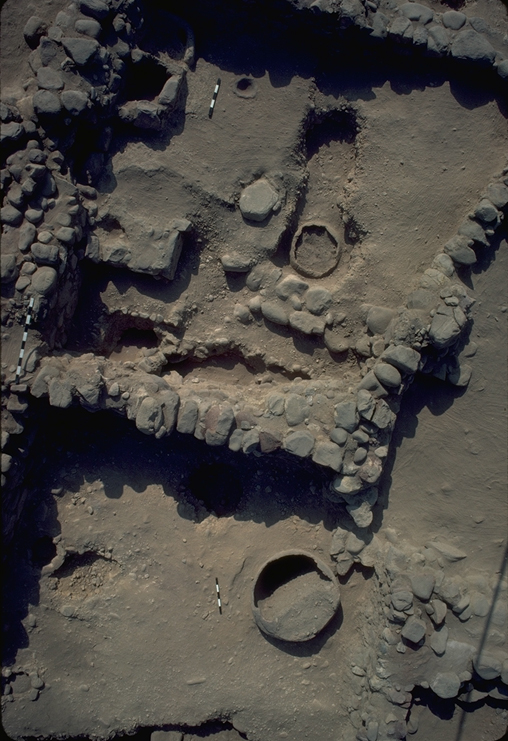
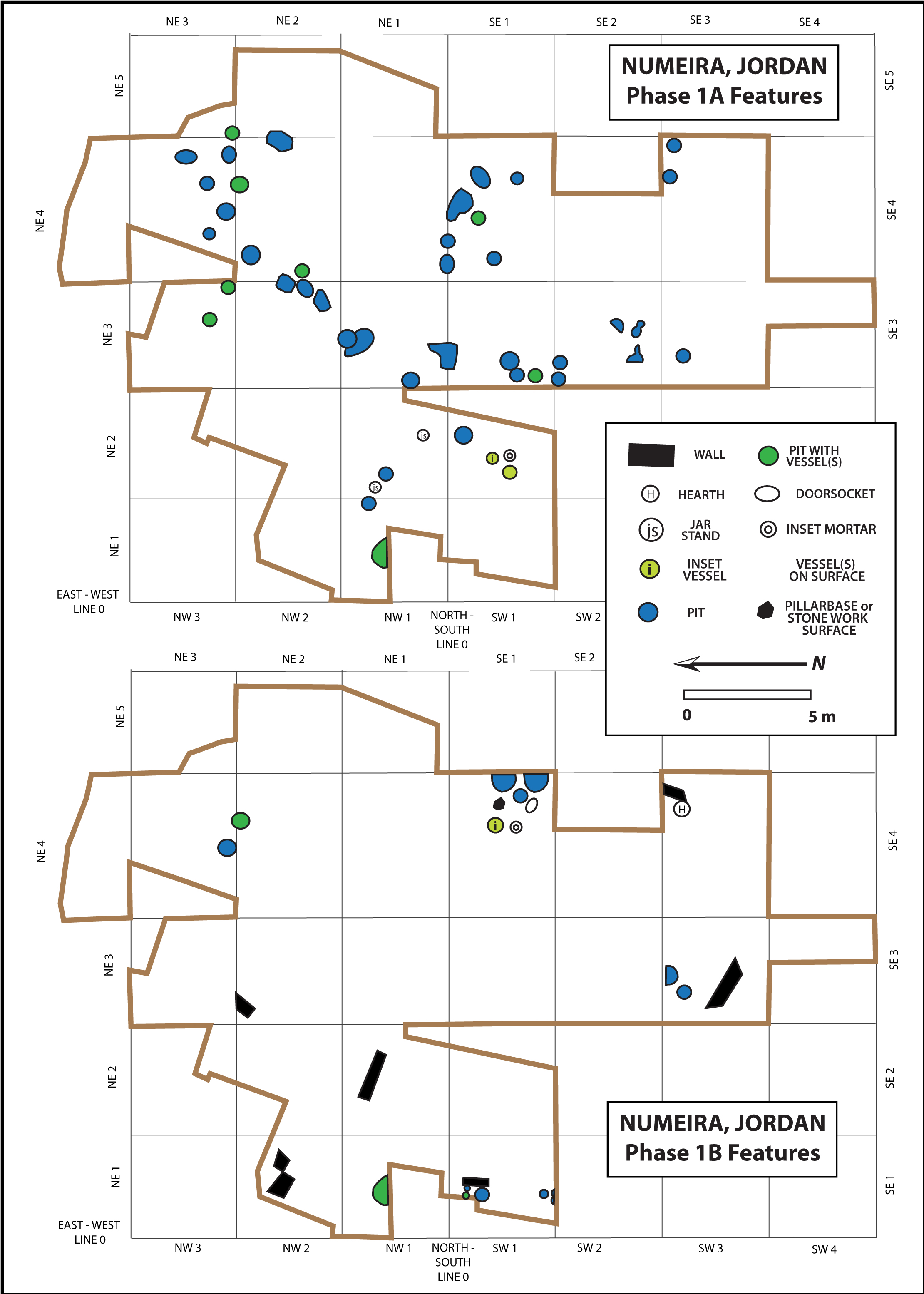
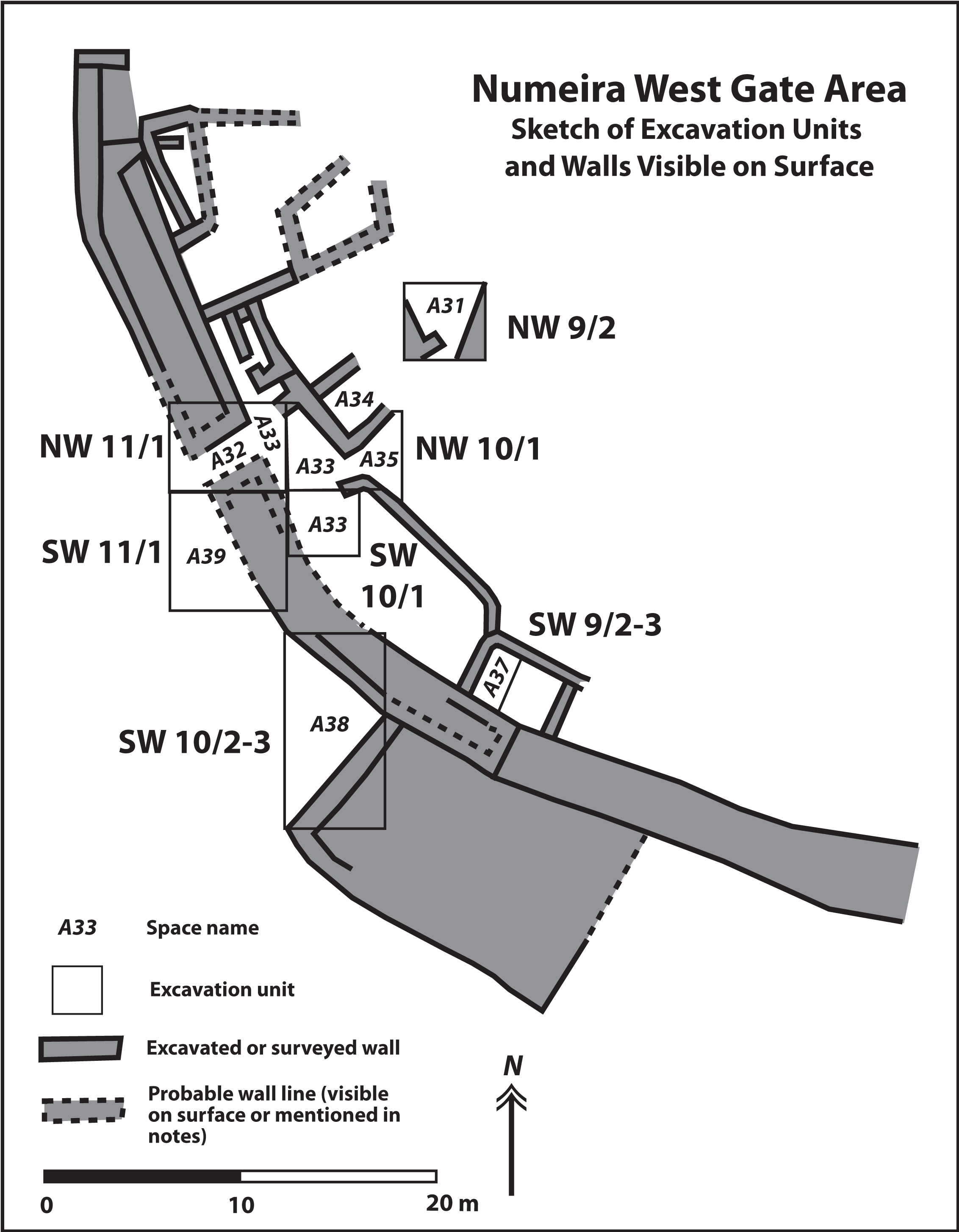
Excavators opened three major areas: the west gate area, the central area, and the east tower area. Three phases of occupation have been identified, and in several areas these phases can be further divided into subphases. The earliest Phase (1) has two subphases: 1A and 1B. The most extensive evidence for 1A and 1B occupation was found in the central area. Phase 1A inhabitants constructed pits, many cobbled and plastered, across the surface of the site, and thus the research team referred to them as the “Pit People” as an easy label. This appellation was confirmed by the evidence: the earliest evidence for occupation at Numayra were numerous pits constructed across the central area of the site during the Phase 1A. Interestingly, some of the pits are arranged around open, roughly rectangular spaces, and there may have been tent encampments associated with these pits. Phase 1B people modified the space slightly by adding more pits and in a few areas we find the earliest stretches of walls, hearths, and evidence for more intensive (or at least more durable and archaeologically visible) use of the site.
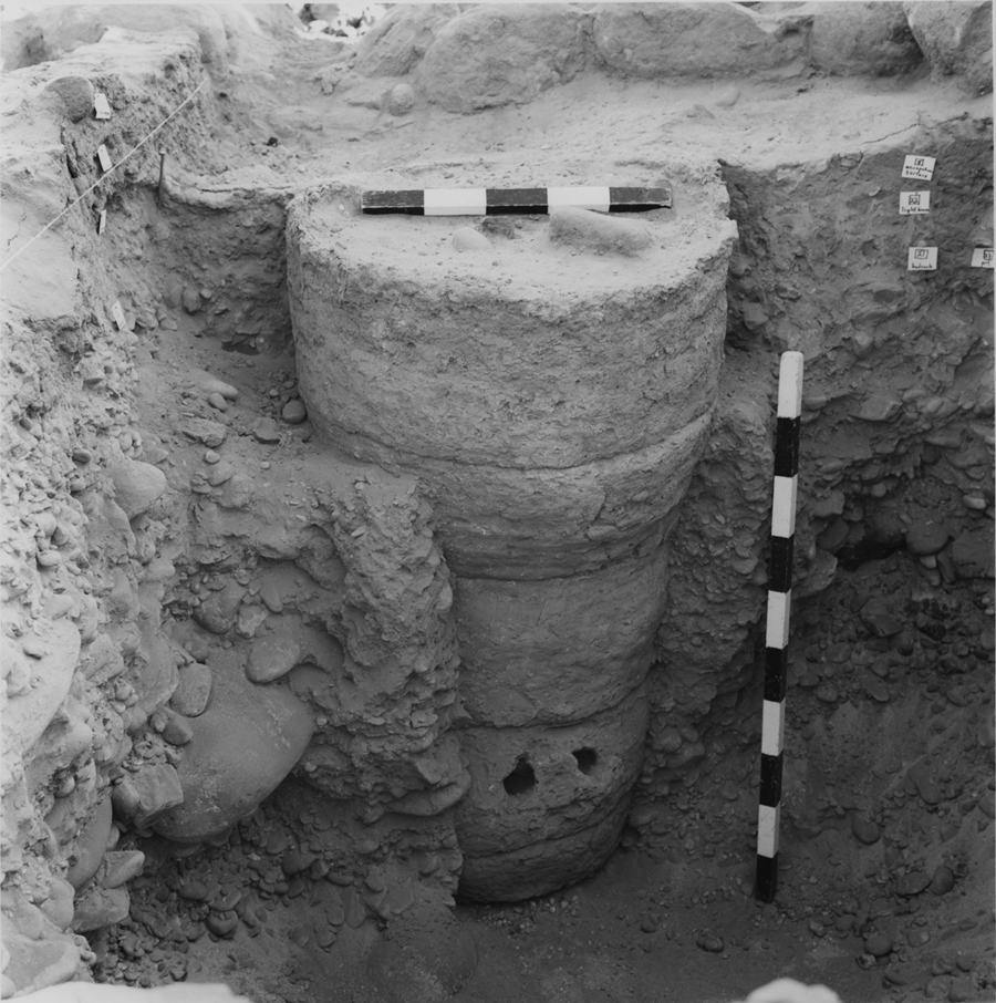
In the East Tower Area, excavators found Phase 1A and 1B architectural evidence for the site’s occupation before builders constructed the fortification walls in Phase 2A. The best stratigraphic evidence for the transition from Phase 1 to Phase 2 was uncovered on the northern units of this excavation area in Rooms 27 and 28 (combined units NE 10/1-2). Excavators uncovered Phase 1B Room 28, which suffered a fire. Inside the room, an adult male had perished in the fire most likely from smoke inhalation and possibly also from the collapse of the roof. Phase 2A builders constructed the town fortification wall directly on top of the collapsed roof and building remains, sealing the body of the deceased male below the Phase 2A town wall.
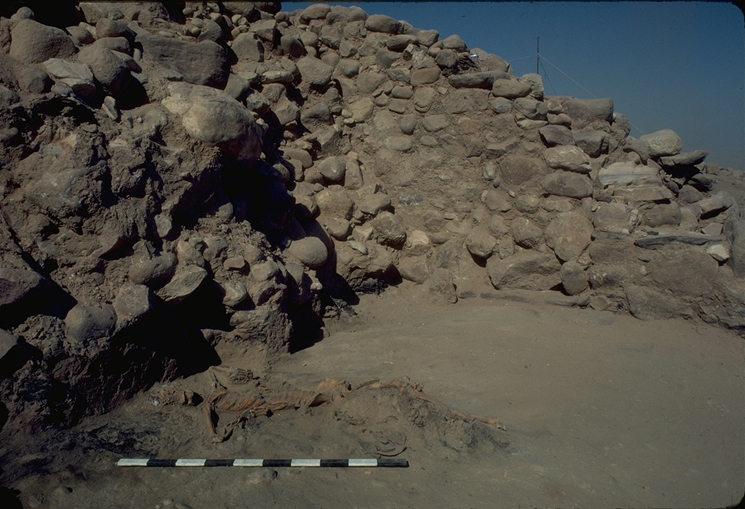
Crushed individual buried below the foundations to the Phase 2A tower in the East Tower Area
Despite the death of this individual in the fire, there is no concrete evidence of any attack or conflict at the end of Phase 1B. Over the 300-year occupation, there are several instances of single rooms burning down and being rebuilt or remodeled. However, these burning events are not widespread or limited to only one subphase. The excavators therefore interpreted these events as isolated fires, likely started by accident, or possibly by lightning strikes.
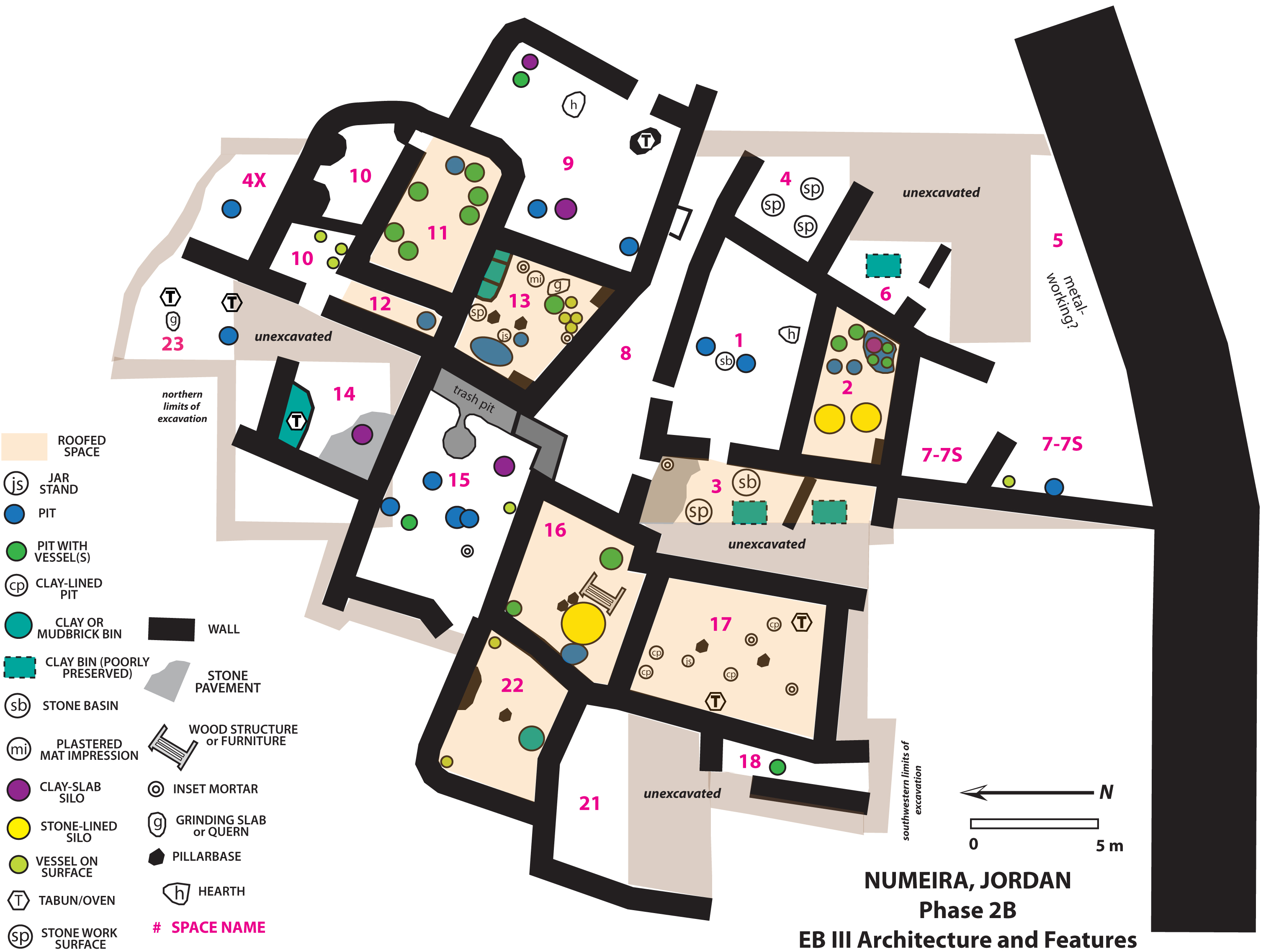
Phase 2 coincides with the construction of the fortification walls and extensive residential and non-residential stone and mudbrick architecture within the town walls in all three excavation areas. In the central area, where approximately 970 square meters were opened, excavators uncovered extensive evidence for everyday life in residential contexts. In many ways the most striking aspect of the Phase 2A remains was the relatively high density of storage features. There were six general categories of storage features recovered in excavations: pits (with or without vessels inside), vessels inset into and lying on floors, clay silos, stone-lined silos, bins, and “poorly preserved storage features” including remains of clay bins, basketry, and large piles of stored agricultural remains which had probably been stored in perishable containers.
During the Phase 2B occupation, inhabitants of the town modified and renovated the built environment. In many cases, they subdivided spaces to create more barriers of access, especially to storage facilities. Many storage pits were reused from the Phase 2A contexts, and more silos and bin were constructed during this phase.
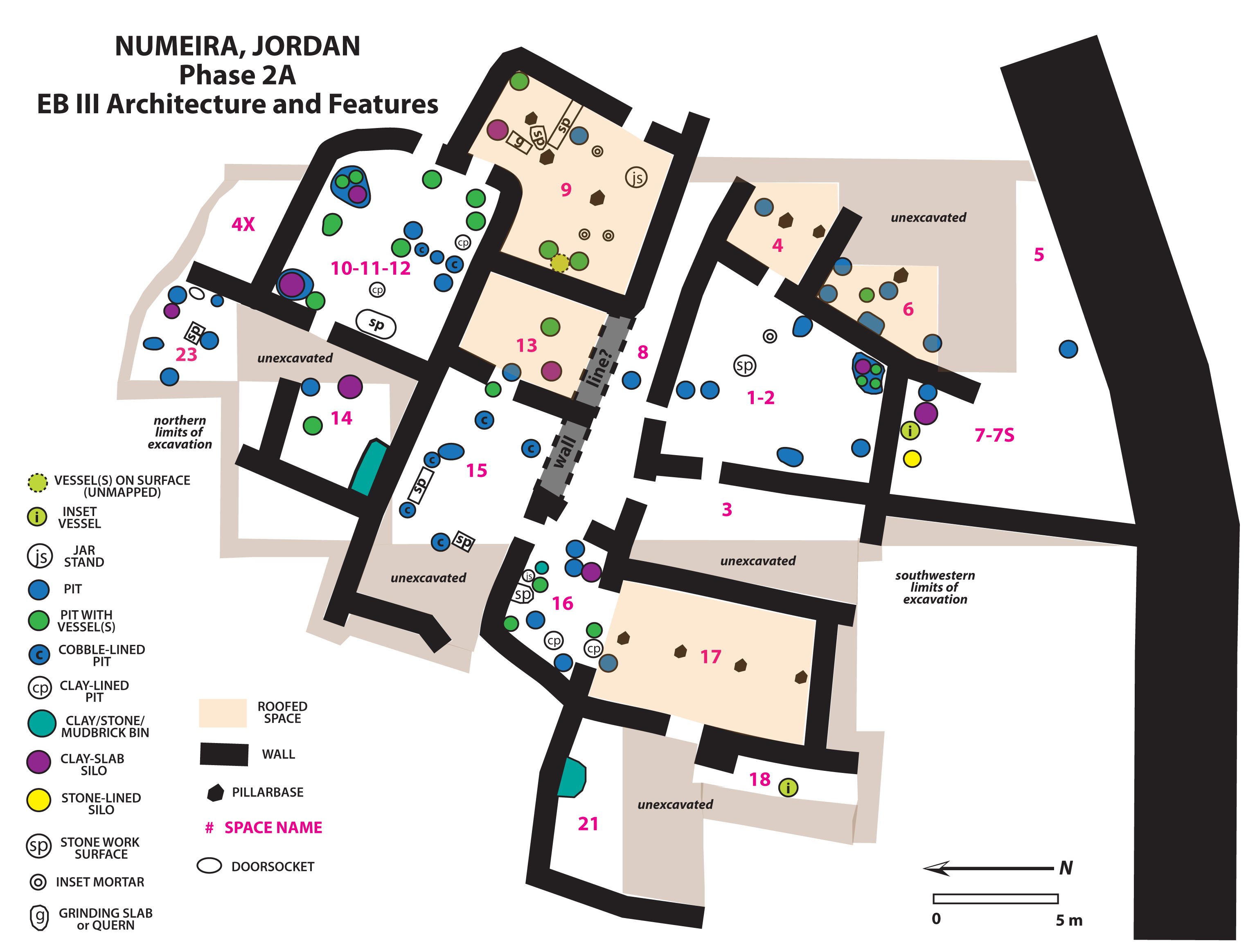
In the central area, where approximately 970 square meters were opened, excavators uncovered extensive evidence for everyday life in residential contexts. In many ways the most striking aspect of the Phase 2A remains was the relatively high density of storage features. There were six general categories of storage features recovered in excavations: pits (with or without vessels inside), vessels inset into and lying on floors, clay silos, stone-lined silos, bins, and “poorly preserved storage features” including remains of clay bins, basketry, and large piles of stored agricultural remains which had probably been stored in perishable containers.
During the Phase 2B occupation, inhabitants of the town modified and renovated the built environment. In many cases, they subdivided spaces to create more barriers of access, especially to storage facilities. Many storage pits were reused from the Phase 2A contexts, and more silos and bin were constructed during this phase.

In the west gate area, where approximately 200 square meters were exposed, excavators found evidence primarily for non-residential spaces, especially focused on the fortification system.
 />
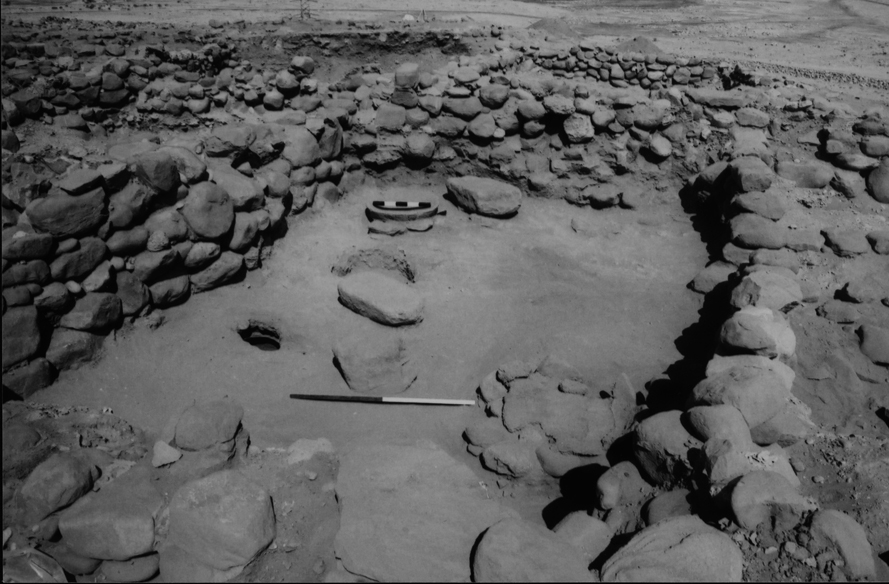
/>The final occupation of Numeira in Phase 2C was limited to a very small portion of the excavated areas, and this last habitation of the settlement ended when the town was burned and one of the fortification towers collapsed, crushing three individuals beneath its walls. The best preserved 2C contexts were found in the Central Area in Rooms 1 and 11.
The completed analysis of chipped stone, ceramic, textile, jewelry, and paleoethnobotanical materials enable the research team to assess the fundamental elements of the economic behaviors at Numayra, and the relationships between activity areas, residential structures and non-residential structures. Because so much of the town has been excavated (c. 16% of the proposed 1 hectare town), we have an extensive sample of the town plan and therefore an excellent case study for exploring the interplay between residential and non-residential spaces between Phases 2A and 2B.
With the publication of the Bab adh-Dhra’ town site volume completed, the publication staff has made Numayra its highest priority. The staff is currently collecting final reports from researchers, and in 2004 conducted a final, short field season to complete an updated plan of the site in relation to the Wadi en-Numayra and the site of Ras an-Numayra, a EB IB site 400 m to the east of the town.